
Description
Kolida K50 Gnss RTK Receiver Positioning – Stakeout & 3D Modeling
CV. Karya Mandiri Techindo has a wide range of Kolida products – search by type, or model, or filter by brand to find the one you are after. If you still can’t find it contact us..
| Visual Positioning & Stakeout & 3D Modeling |  | 1698 Channels All Constellation Signal Tracking | | Farlink 2.0in-built Radio | | Ultra Rugged Robustness |
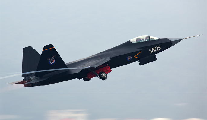 | The Brand New GNSS Engine: S805 The S805 GNSS chip features new chip design and dual-engine algorithm, which is able to eliminate the false-fixed solution status and make compensation to the error by ionospheric delay, to improve the reliability of measurement result and working efficiency in harsh environment.
|
| Data Collection, By Shooting Video or Photo With Kolida’s advanced photogrammetry technology, K50 user can easily acquiring coordinates for hundreds of points within minutes, by using the front camera to shoot a video or some photos. See the example video from https://youtu.be/Q2AZh6aWj6s | 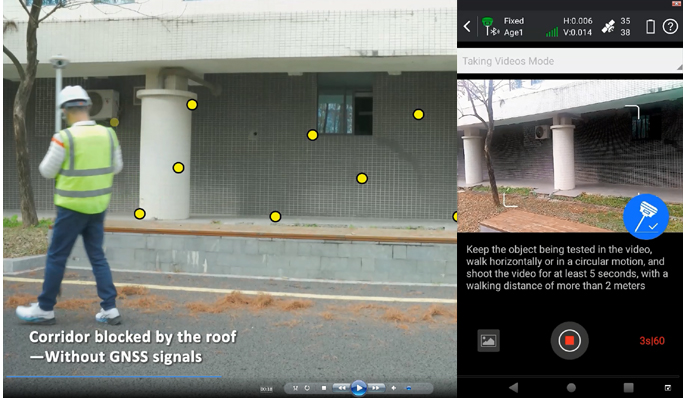 |
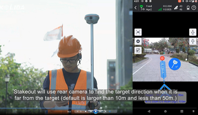 | Stakeout, with Dual-Camera When surveyor is performing stakeout with K50, the Ksurvey App will call upon both front and bottom camera to capture the real-time imagery and display AR guide lines to help. The job can be done faster, more accurate, more intelligent. Watch video at https://youtu.be/M-vjnyzKseM
|
| 3D Modeling, The New Value Added Surveyors can use K50 to capture photoes of the objectives and process out 3D model. The data output can be used with the 3rd party designing software, also can be combined with Drone (UAV) data, such as DJI and other brands. | 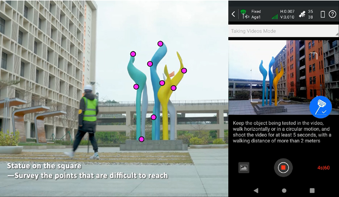 |
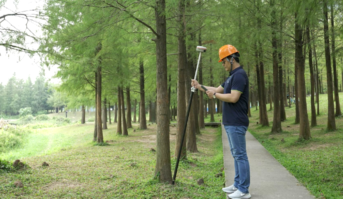 |
More Advanced IMU Tilt Survey With the latest upgrade of KOLIDA’s IMU tilt survey technic, the working status of IMU module won’t be interrupted when surveyor rotates the pole or changing their walking direction. It greatly saves time and smoothies the work flow.
|
|
New Radio, Farlink 2.0 Farlink technology is developed to send large number of data and avoid data loss. This new protocol improves the signal-catching sensitivity from -110db to -117db, so K50 can transmit to 10 even 15 km away by only 2 watt power consumption (in optimal environment condition). | 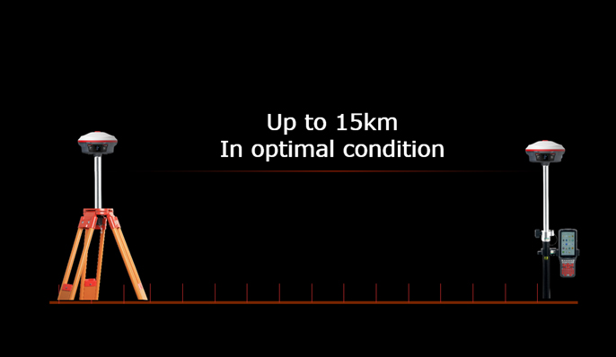 |
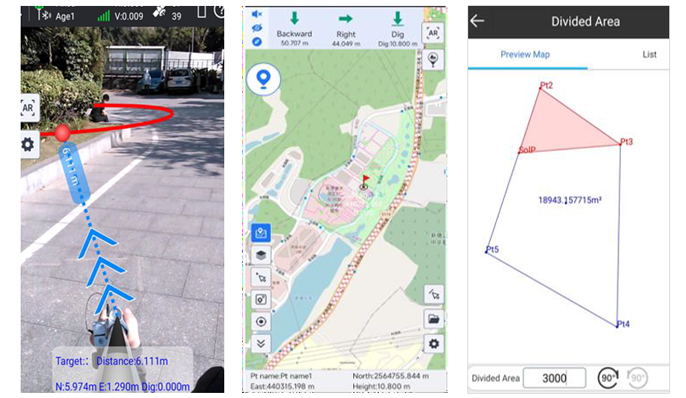 |
Ksurvey App, Increase Your Output. Ksurvey App features a series of practical and unique functionalities: Measure & Draw, CAD Drawing, Visual Positioning, CAD Stakeout, Area Division… (Video: https://www.youtube.com/playlist?list=PL3pUfw29oHQPucI0RkexQOyANywA2efjf) Ksurvey also enable users to work it with Kolida total stations.
|
| Kolida GEO Office, Ideal GNSS Data Processor
KGO is designed to help surveyors to process static data, PPK data, photogrammetry data accurately and productively. 3D modeling function has been added in 2024. | 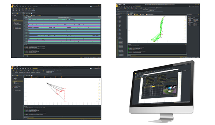 |
| Satellite Tracking Ability | ||
| Channels1698 channels | ConstellationGPS, GLONASS, BEIDOU, GALILEO, QZSS, SBAS | L-BandReserved |
| Positioning Output Rate1-20 HZ | Initialization Time2-8 s | |
| Positioning Precision | ||
| UHF RTKHorizontal ±8mm +1 ppm Vertical ±15mm +1 ppm | Network RTKHorizontal ±8mm +0.5 ppm Vertical ±15mm +0.5 ppm | |
| Static and Fast-Static Horizontal ±2.5mm +0.5 ppm Vertical ±5mm +0.5 ppm | RTK Initial time 2-8s | |
| User Interaction | ||
| Operation SystemLinux | Screen DisplayNot Available | wifiYes |
| Voice Guideyes, 8 language | Data Storage16 GB internal, 64 GB external | Web UIYes |
| Keypad1 physical buttons | ||
| Working Capability | ||
| Visual PositioningShooting photo or video to measure coordinate | Visual Stakeout with AR Uses Dual-Camera to stakeout pts, lines, CAD | 3D ModelingProcess by Post-processing software |
| RadioBuilt-in transmitting and receiving, 1/2 W | Tilt Survey Inertial Measurement | Electronic BubbleYes |
| Enduranceup to 16 hours (static mode), up to 12 hours (rover mode), up to 10 hours (UHF base mode) | OTG (Field Download) yes | |
 Kolida K50 – Brochure

KARYA MANDIRI TECHINDO merupakan supplier peralatan ukur dan uji terlengkap di Indonesia. Kami menyediakan berbagai alat Radio Komunikasi, Telpon Satelit, Surveying Instruments, Survey Tools, Binocular, Alat Ukur & Uji, Alat Analisa Air & Food dan Sirine.
KARYA MANDIRI TECHINDO adalah Supplier Kolida K50 Gnss RTK Receiver Positioning – Stakeout & 3D Modeling di Jawa Barat & Jakarta dan juga menjual Brand Kolida dll. lihat produk kami lainnya di sini JSI, SGI, SMG atau hubungi kami melalui Whatsapp 0821-3010-0456. atau melalui email [email protected].
Dalam pengiriman produk yang pelanggan beli, sebelumnya sudah kami cek untuk memastikan produk dalam keadaan baik dan siap kirim.