Description
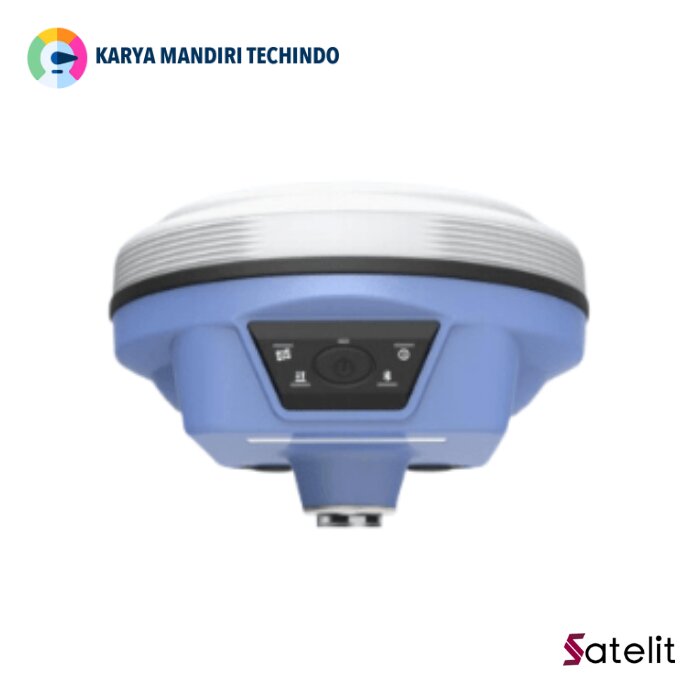
Satelit S1 GNSS RTK
CV. Karya Mandiri Techindo has a wide range of Satelit products – search by type, or model, or filter by brand to find the one you are after. If you still can’t find it contact us..
Application
- Control Survey: dual-band (dual frequency) system static measurement can accurately complete high-precision deformation observation, photo control point measurement.
- Highway Survey: quickly complete control point encryption, road topographic mapping, cross-section measurement, profile measurement with EGStar.
- CORS Application: provides more stable and convenient data link for field operations. It is perfectly compatible with all kinds of domestic CORS applications.
- Data acquisition measurement: perfectly matched with various South measurement software to carry out fast and easy data acquisition.
- Reconnaissance shooting: large-scale points, lines, lofting planes.
- Electric Power Measurement: power line measurement orientation, range, angle calculation.
- Marine Application: oceanographic research, dredging, piling, inserted lines, making marine operations convenient and easy.
Features Satelit S1 GNSS RTK

Lighter And Faster
Only 790g in weight, S1 is still packaged with the magnesium alloy shell. High integrated design, smaller and lighter, fully consider surveyors needs. Easy carry and pack with its handy size

IMU For Tilt Survey
S1 epuipped with the latest Inertial Measurement Unit (IMU). Featured with anti-magnetic characteristic, you can start the tilt survey in any place. Shaking to initialize the IMU sensor, no need to calibrate. Up to 100Hz IMU data output rate, down to 2cm accuracy.

Colourful LED Indicators
The colorful LED indicators can briefly show the current status. Tracking Satellites: Green Indicator flashes when tracking satellites. On: Red indicator will on when receiver turning on.

Longer Battery Life
Because of the latest SOC technology, S1 achieves higher performance and lower power consumption. The built in 6800mAh Li-ion battery can continuously work 15 hours(Rover Bluetooth mode).

Smart Indications
One click press to know battery remain capacity. Without connecting to any software, without logging in to WEBUI to know battery status by a simple press. 100%~75% 75%~50% Work mode, Datalink, Channel number easy to know by its voice indication.
All these smart indications were designed to increase the working efficiency.

Supercharged By SoC Technology
S1 is a new product from SANDING SoC platform, most components of C7 (GNSS module, Wi-Fi, Bluetooth, etc.) are integrated on one circuit board. C7 has lower power consumption, and efficiently improves the ability of receiving higher quality satellites signals.
 Satelit S1 – Brochure

KARYA MANDIRI TECHINDO merupakan supplier peralatan ukur dan uji terlengkap di Indonesia. Kami menyediakan berbagai alat Radio Komunikasi, Telpon Satelit, Surveying Instruments, Survey Tools, Binocular, Alat Ukur & Uji, Alat Analisa Air & Food dan Sirine.
KARYA MANDIRI TECHINDO adalah Supplier Satelit S1 GNSS RTK di Jawa Barat & Jakarta dan juga menjual Brand Satelit dll. lihat produk kami lainnya di sini JSI, SGI, SMG atau hubungi kami melalui Whatsapp 0821-3010-0456. atau melalui email [email protected].
Dalam pengiriman produk yang pelanggan beli, sebelumnya sudah kami cek untuk memastikan produk dalam keadaan baik dan siap kirim.