


Description
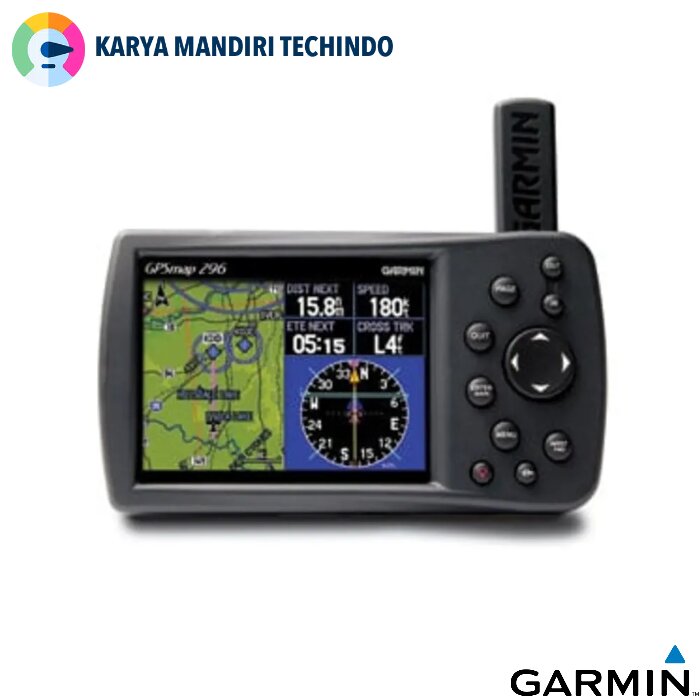
Garmin GPSMAP 296
Karya Mandiri Techindo has a wide range of Garmin products – search by type, or model, or filter by brand to find the one you are after. If you still can’t find it contact us..
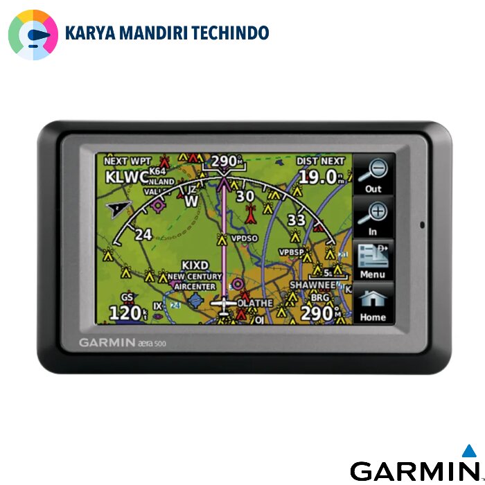
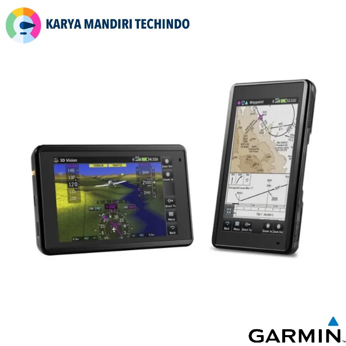
Taking terrain awareness to a whole new level, the GPSMAP 296 is a color aviation portable with built-in terrain mapping and alerting.
Enhance Situational Awareness
GPSMAP 296 comes with a detailed built-in Jeppesen® database along with terrain and U.S. obstacle databases. Using this information, the 296 provides detailed views of your flight route, displayed over realistic topography. For added safety, you can put the unit in Terrain mode for TAWS-like warnings and alerts when proximity conflicts loom ahead.
View Images in Sharp Detail
Viewing the display in any light is easy, thanks to the unit’s 256-color, high-resolution (320 x 480-pixel) sunlight-readable TFT display with adjustable backlighting. The 296 also features USB data transfer, fast processing speed and a rechargeable lithium-ion battery pack.
Automate Your Logbook
A built-in logbook tracks your flying hours and automatically records departure and arrival locations. When used with Garmin’s free logbook software, FlightBook, this feature simplifies recordkeeping. Flightbook software allows you to create, manage, analyze, save and print flight data from the GPSMAP 296’s logbook.
Navigate by Air, Land or Sea
Simply press a button to switch GPSMAP 296 to automotive or marine mode. The 296 comes with a built-in routable basemap. Add optional MapSource® detailed street maps to receive voice-prompted turn-by-turn directions to addresses and points of interest. For a great day on the water, customize the water resistant 296 with optional marine cartography. Easily add detailed maps with plug and play Garmin data cards.


Specifications Garmin GPSMAP 296
| General | |
| PHYSICAL DIMENSIONS | 5.7″W x 3.2″H x 1.9″D (14.5 x 8.1 x 4.8 cm) |
|---|---|
| DISPLAY SIZE | 3.2″W x 2.1″H (8.1 x 5.3 cm); 3.8″ diag (9.7 cm) |
| DISPLAY RESOLUTION | 480 x 320 pixels |
| DISPLAY TYPE | 256 color TFT with backlighting |
| WEIGHT | 13.6 ounces (385.5 g) |
| BATTERY TYPE | rechargeable lithium-ion |
| BATTERY LIFE | up to 15 hours (Battery Saver mode, no backlighting) |
| MEMORY/HISTORY | internal solid state |
| IFR OR VFR | VFR |
| Maps & Memory | |
| ABILITY TO ADD MAPS | yes |
|---|---|
| BASEMAP | yes |
| EXTERNAL MEMORY STORAGE | yes (Garmin data cards) |
| WAYPOINTS/FAVORITES/LOCATIONS | 3,000 |
| ROUTES | 50 |
| Databases | |
| NAVIGATION DATABASE (INCLUDES JEPPESEN® DATA) | yes |
|---|---|
| NAVIGATION DATABASE COVERAGE AREAS | Americas, Atlantic International or Pacific International |
| TYPES OF JEPPESEN DATA | full and ARTCC, FSS frequencies and final approach waypoints |
| PRELOADED TERRAIN DATABASE | yes |
| PRELOADED OBSTACLE DATABASE | yes |
| Aviation Portable Features | |
| MOVING MAP | yes |
|---|---|
| PATENTED PANEL PAGE | yes |
| HSI (GPS-BASED) | yes |
| TERRAIN RESOLUTION | standard |
| AUTOMATIC LOGBOOK | yes |
| SEPARATE SERIAL AND USB INTERFACES | |
 Garmin GPSMAP 296 – Manual

KARYAMANDIRI TECHINDO merupakan supplier peralatan ukur dan uji terlengkap di Indonesia. Kami menyediakan berbagai alat Radio Komunikasi, Telpon Satelit, Surveying Instruments, Survey Tools, Binocular, Alat Ukur & Uji, Alat Analisa Air & Food dan Sirine.
KARYAMANDIRI TECHINDO memiliki berbagai macam produk dari berbagai Merk di antaranya :
Alat Ukur & laboratorium : Lutron, Benetech, Sanfix, Landtek, UNI-T, Fluke, Kyoritsu, GW Instek, Lodestar, Aditeg, Hioki, Hikmicro, AZ Instrument, Extech, Siglent, AMPROBE, Sanwa, Tunkia. Alat Survey : E-Survey, SKYRAY, Furuno, STEC , Topcon, Sokkia, Leica, Xirius, Nikon, Alpha, Hi-Target, Trimble, Sdhdvd, Acnovo, My’sury, Minds, Ruide. Alat Telekomunikasi : Hytera, Motorola, Baofeng, Alinco, Firstcom, Weierwei, Icom, Kenwood, Yaesu, Verxion. Telepon Satelit : Thuraya, Inmarsat, Iridium. Sirine : Iterno, Vorge, Fort, Yahagi, Lion King. Binocular : Bushnell, YUKON, Zenith, Decathlon, APEXEL, Nikon, K&F, Yazumi – SINHER, BOSTRON / AOMEKIE